Main / Sights
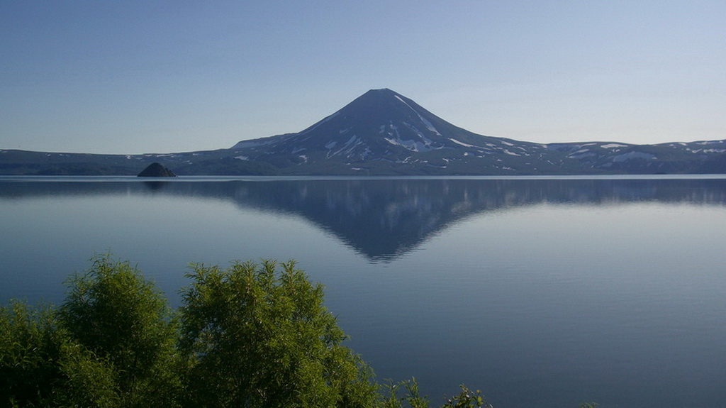
KURILE LAKE
The lake is located in the east part of the Pauzhetskaya depression and fills a deep caldera which was formed after the extra depression of the bottom. It was caused by the magmatic chamber exhaustion after the Ilyinsky and the Wild ridge volcanoes eruptions.
The lake is located at the absolute height of 104 m, the depth of the lake is more than 300 m, the bottom is 200 m lower the sea level. Kamchatka doesn’t have one more lake with such a peculiarity. The maximum size of the lake is 9x11 km. It is the third lake of Kamchatka in size and the second freshwater lake after the Kronotskoyelake. Besides, the Kuril lake is the 7th in depth among all reservoirs of Eurasia. The archeological excavations show that the first settlements in Kamchatka existed more than 15 thousand years ago (near the Ushkovskoye Lake). Probably, they were also in the south of the peninsula and in the area of the Ozernayariver. When the catastrophic eruptions started, the residents moved to safe areas, but the information about it remained in the memory of the descendants and was presented as a legend for Krasheninnikov. The summary is the following: “Once there was a high mountain instead of the lake. The mountain was so high, that it shaded the sun for the close mountains. And the mountains were very angry about it and often quarreled. And, finally, the high mountain became tired of it – she stood up and went to the sea. She left only her heart in the place she stood, and the river traced the mountain to the sea”.
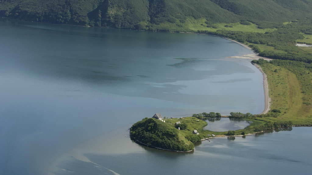
The southernmost island really resembles a heart. In Krasheninnikov times the island was called the Heart-rock, bow it is called the Alaid Heart. The volcano and the northernmost island of the Kuril chain were called Alaid. The island was later recalled the Atlasov island, but the volcano remained its name.
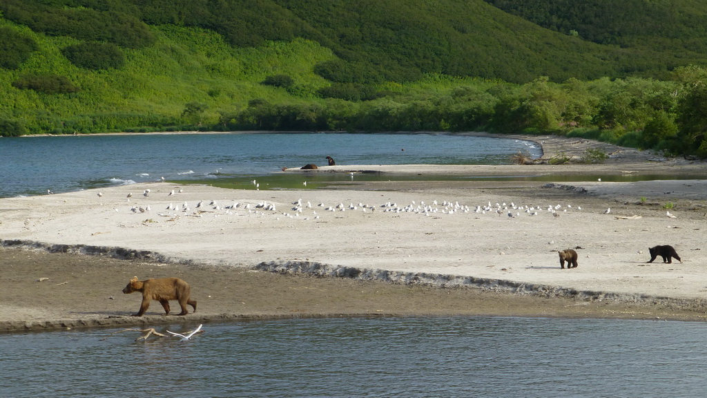
During the caldera formation the viscous magma masses were pressed out from the bottom. The Alaid Heart, two Chayachy islands and the Samang archipelago of four islands were formed. The inaccessible Alaid Heart and the Chayachy islands are the places where the seagulls have nests. But there is no enough feed for the large colony in the lake. In the morning the flocks fly to the Okhotskoyesea over the Ozernaya valley for feed in 40 km from the breeding site. At the sea coast near the fish factory they eat the fish offals and fly back the same way. They feed their nestlings by half-digested food.
The Kuril thermal springs are located at the bottom of the lava slope of the Ilyinsky volcano, in the East Warm bay at the east coast of the lake. The temperature of the streams is 35-37°C.
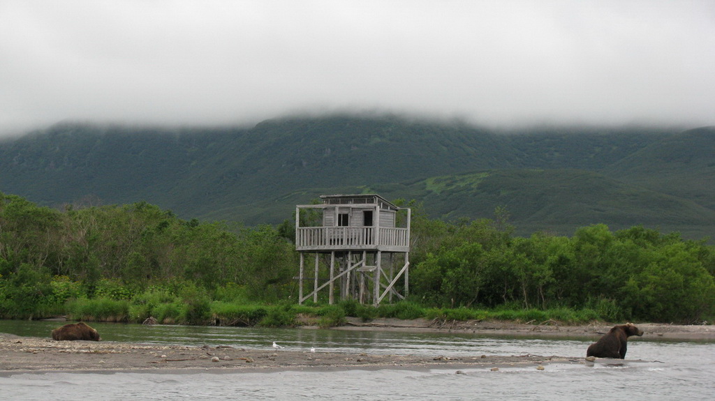
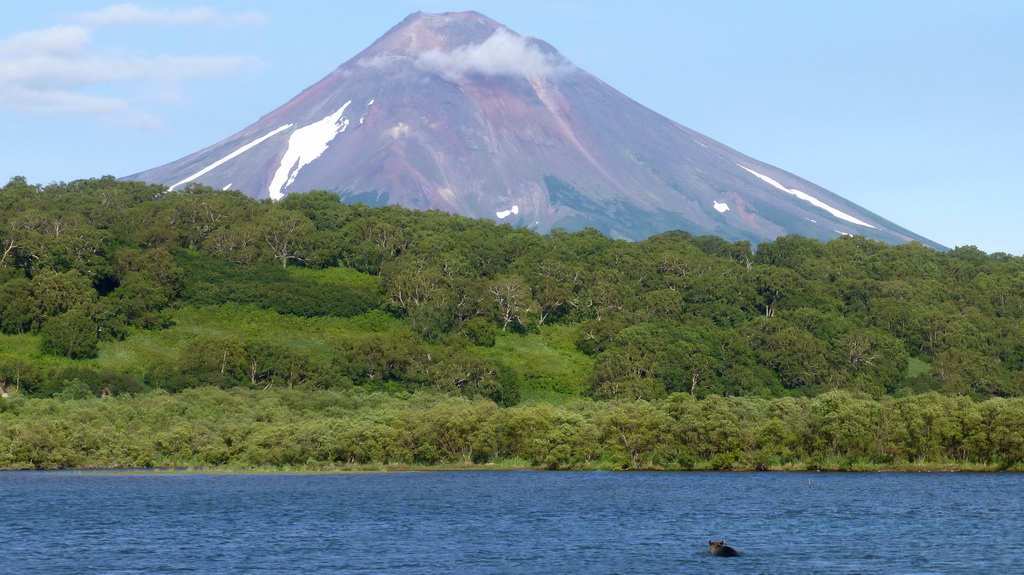
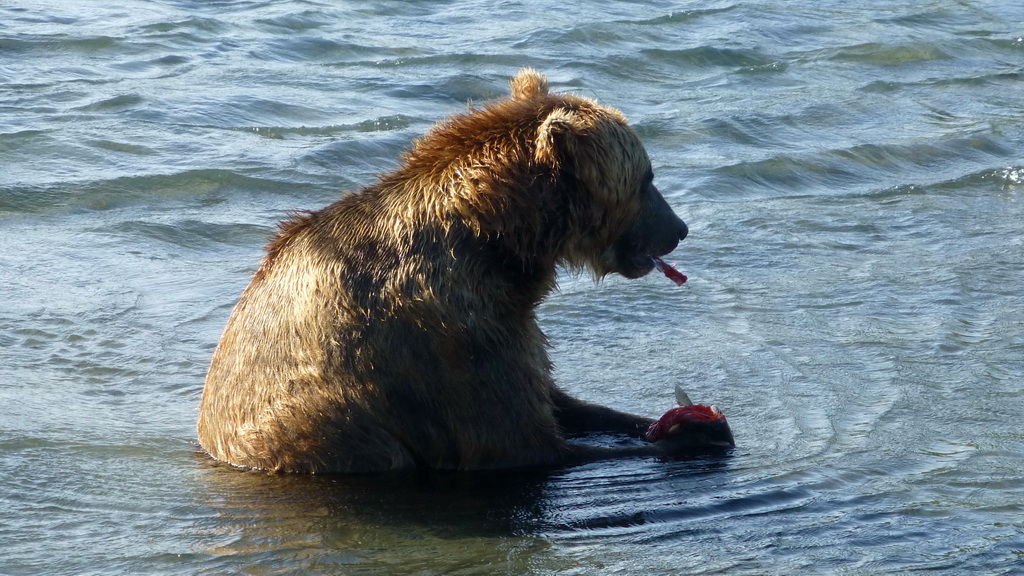
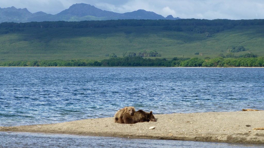
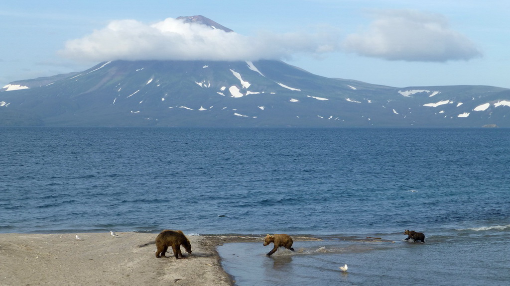
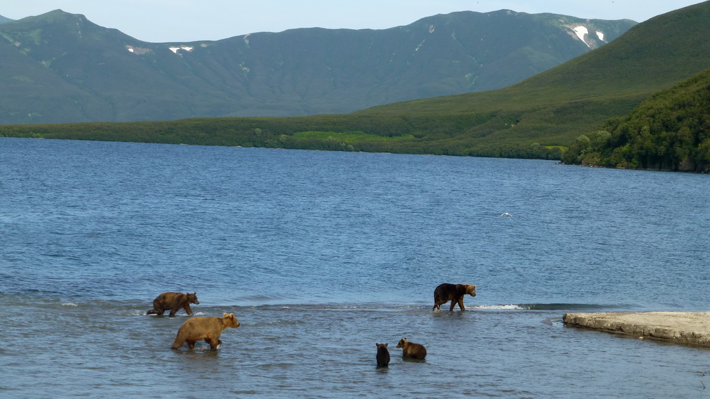
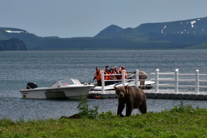
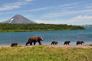
The Kuril Lake is a unique natural object because the greatest population of brown bear inhabits the area of the Lake. Nowadays the total number of the population is 1000 animals. The unique ecosystem of the Kurile Lake was formed and is still preserved because of the reproduction of the greatest herds of the valuable Pacific salmon – the red salmon. Every year 3-10 million spawners come to the Kurile Lake. This abundance of fish attracts a lot of predators, including bears.
Tours
 One-day excursion to the Kurile Lake
The Kurile lake is a unique natural object because the greatest population of brown bear inhabits the area of the lake. ...
One-day excursion to the Kurile Lake
The Kurile lake is a unique natural object because the greatest population of brown bear inhabits the area of the lake. ...
 Kurile Lake. Volcanoes Gorely, Avachinsky and Tolbachik
We would like to offer you tour to the extraordinary by its beauty Kuril Lake, where you are to watch the brown bear ...
Kurile Lake. Volcanoes Gorely, Avachinsky and Tolbachik
We would like to offer you tour to the extraordinary by its beauty Kuril Lake, where you are to watch the brown bear ...
