Main / Sights
VALLEY OF GEYSERS
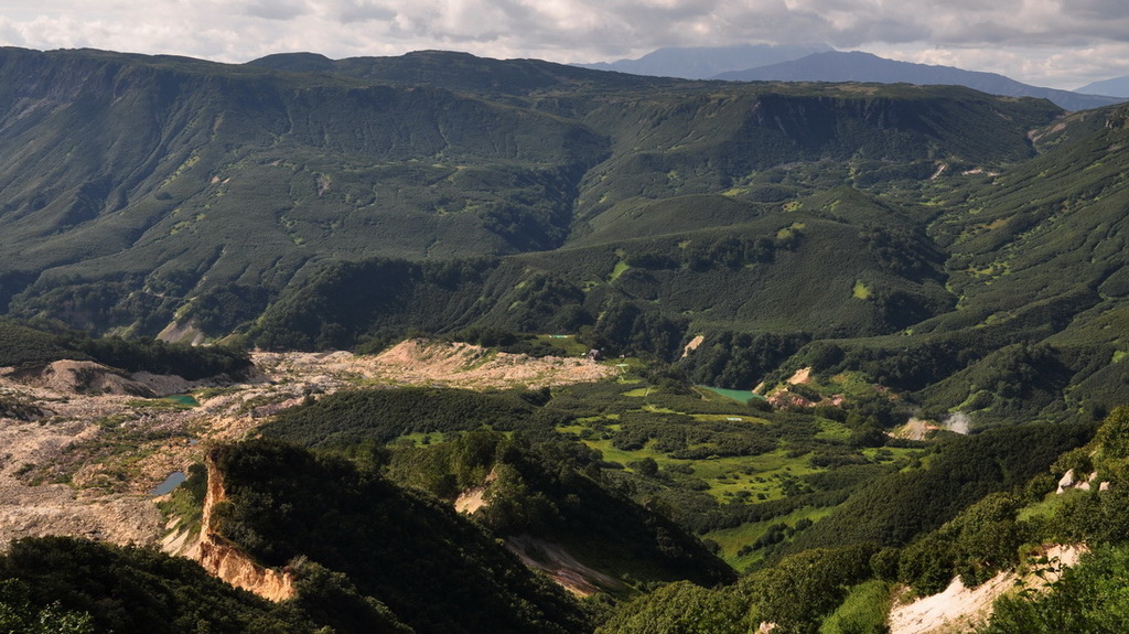
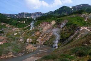
The valley of the Geysernaya River is located in 180 km to the north-east from Petropavlovsk-Kamchatsky among the volcanoes stretched along the east coastline of the peninsula near the so called East Volcanic Belt.
It was discovered in July, 25, 1941, by the reserve worker T.I. Ustinova and the laboratory assistant A.P. Krupenin. This event was preceded by the discovery of the geyser (the Pervenets – the Firstborn) in the Shumnaya river canyon on April, 14, 1941.
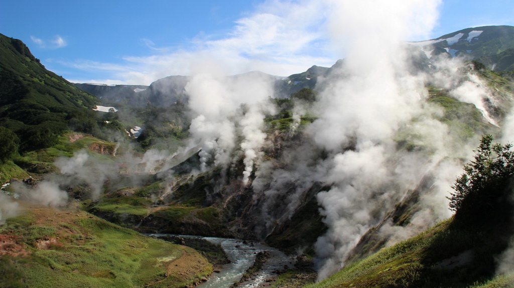
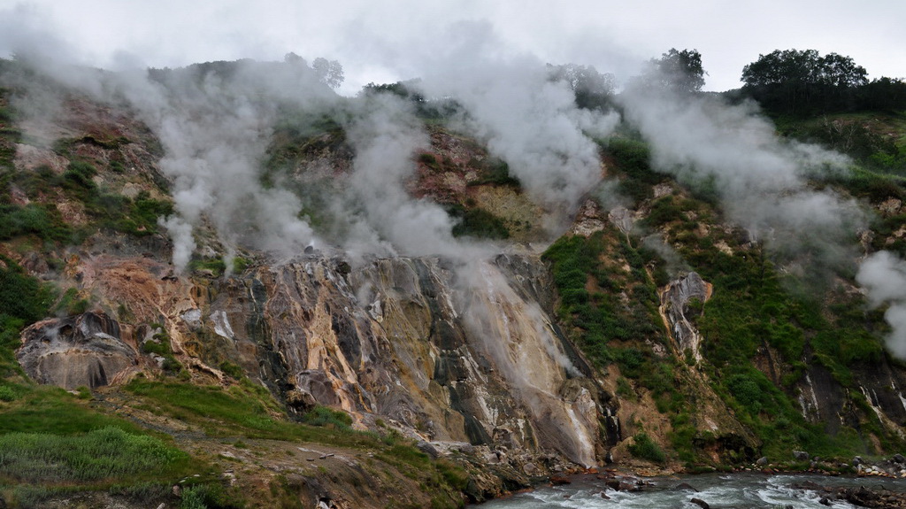
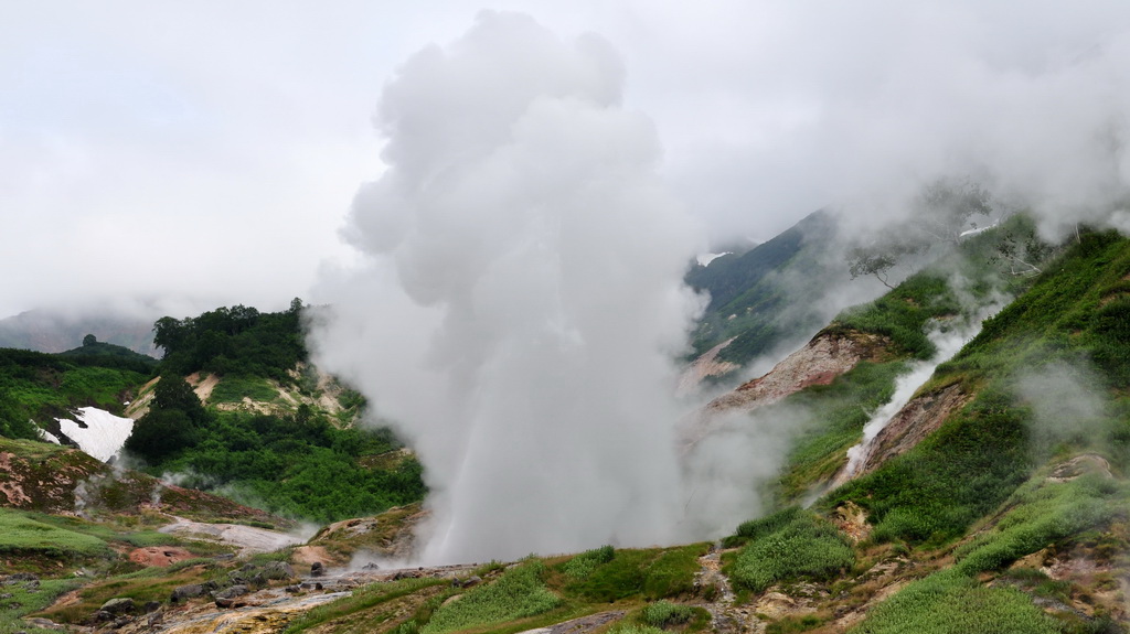
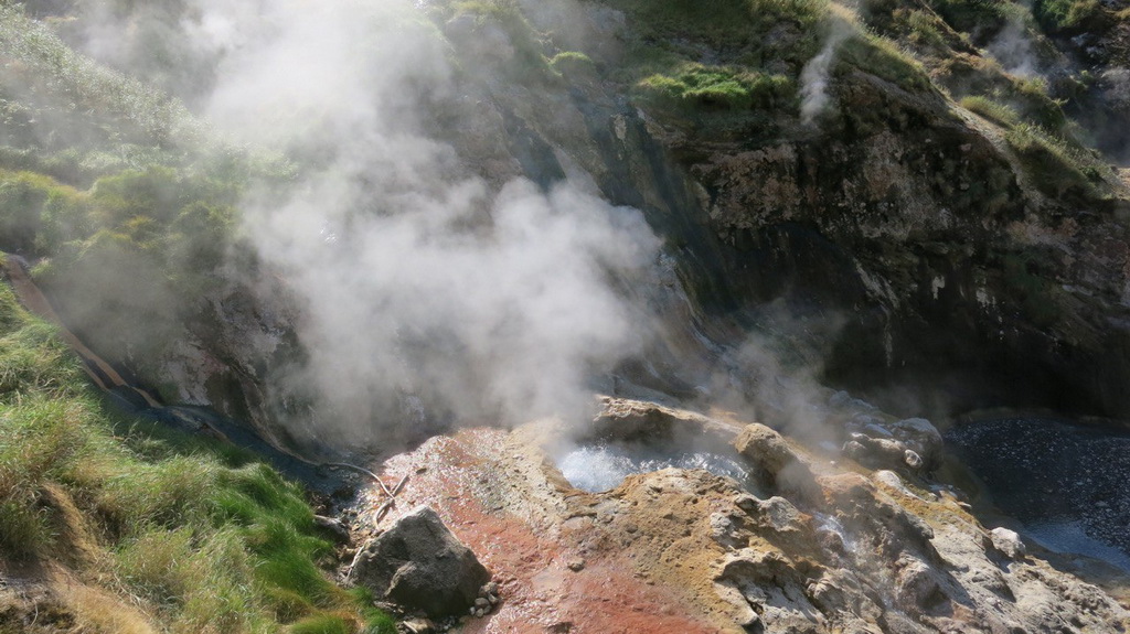
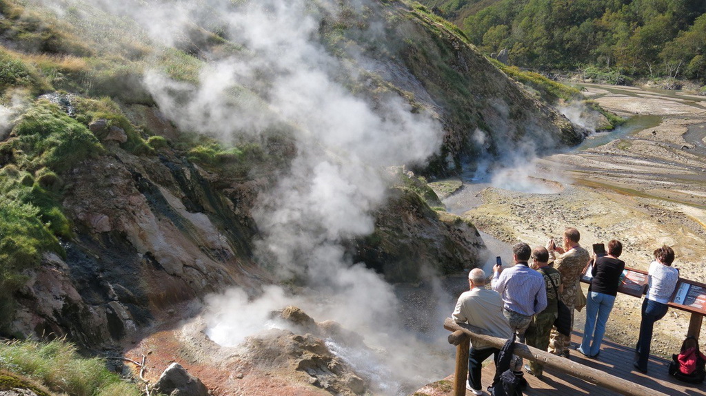
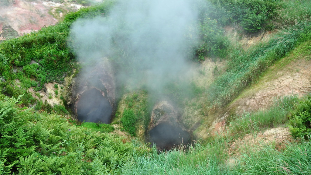
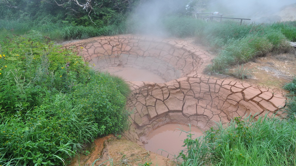
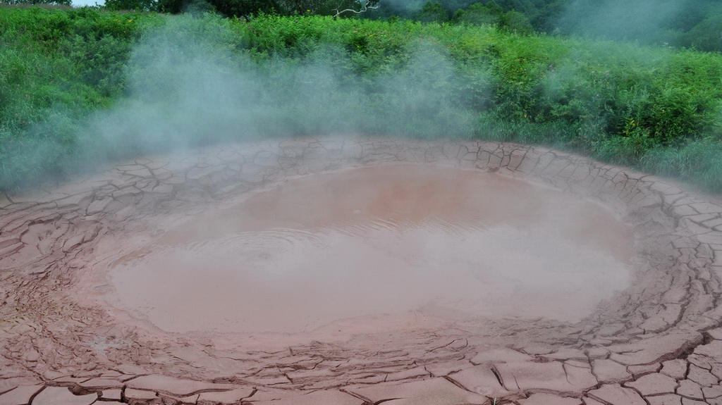
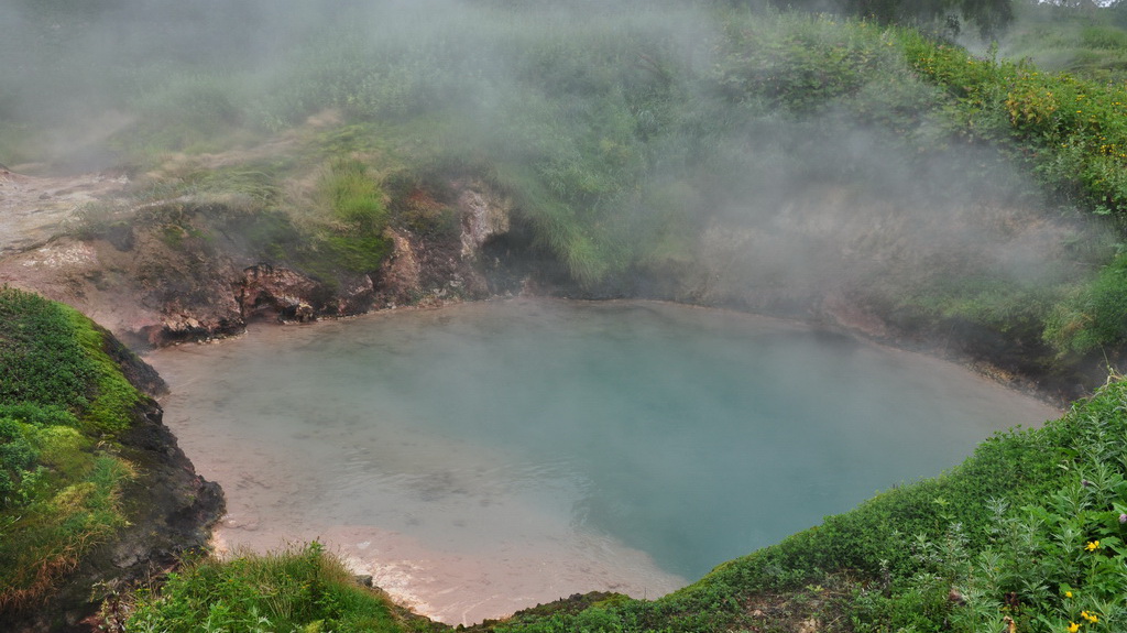
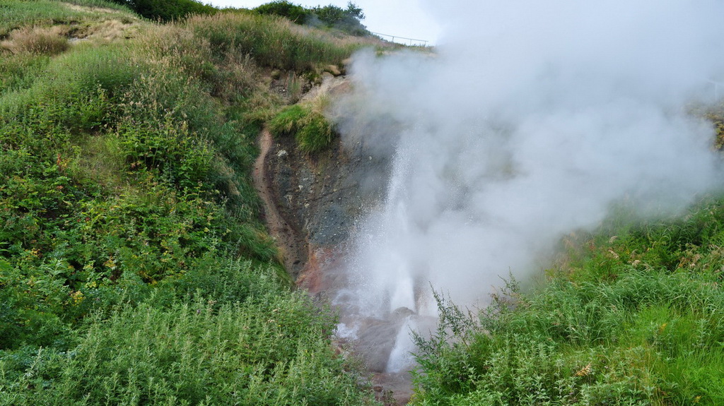
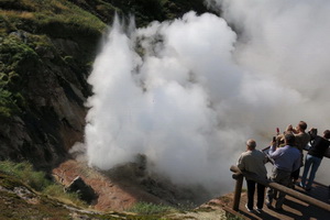
The Valley of Geysers is a canyon with 4 km width, 400 m depth and 8 km length, the Geysernaya river flows in it. There are tens of such canyons in Kamchatka, but there, in 6 km from the estuary, more than 40 geysers and a lot of thermal springs are located; they are divided into 9 sections. The excursion ecological path passes in the central part of the Valley. The tourists can observe all contemporary forms of hydrothermal activity including permanently active and pulsating boiling springs, hot lakes, geysers, mud pools, mud volcanoes, vapour streams, warmed grounds closely located at the small area.
In 2007, 3d of June, 2.20 p.m. the natural catastrophe happened in the Valley of geysers – in the result of the Vodopadny (Waterfall) brook steep slopes failure and major blocks fragmentation the landslide with mudrock flow was formed.
The water-flooded rock mass formed a mudrock flow of water, snow, blocks and different fragments, which spread down with 35-40 km/h speed rooting trees and bushed away.
The flow reached the Geysernaya river and rushed down the current to the mouth. The dam was formed in the place where the Vodopadny brook fell into the Geysernaya river; the extended lake was formed upstream the dam.
The second phase came in 2,5 minutes after the mudrock flow – the slopes of the Vodopadny brook head collapsed. The debris avalanche of the second phase (almost “dry”) rushed down over the first phase mass, and stopped in 1 m from the helicopter deck and the reserve house at the absolute mark of 500 m.
In the result the failure circle with 150 m wall and 800 m length was formed. The landslide and the debris avalanche stretched for 1,7 km with 0,2-0,4 km width.
After the landslide which formed the dam in the Geysernaya river, the river waters had been accumulating in front of the dam for 4 days, and when the lake water level exceeded the height of the dam, it was partially eroded. The river ran into the dam for 8-10 m. The water level fell on 9 m for 4 hours. The landslide material was washed along the Shumnaya river current. The maximum depth of the lake is 20 m. The landslide is referred to giant, the volume of the mass is about 20 000 000 m3. It is the greatest historical landslide in Kamchatka, and one of the greatest in Russia.
The landslide covered very beautiful places: waterfalls, thermal grounds, geyser constructions. Only the fortunate coincidence of circumstances didn’t cause the life losses. The constructions in the Valley of Geysers were also not damaged.
Tours
 Three-day excursion to the Valley of Geysers and Uzon Caldera
Unlike the standard one-day excursion, our ecological educational tour will let you not only to see these unique places ...
Three-day excursion to the Valley of Geysers and Uzon Caldera
Unlike the standard one-day excursion, our ecological educational tour will let you not only to see these unique places ...
 One-day excursion to the Valley of Geysers and Uzon caldera
The famous Valley of Geysers is a canyon which has one of the biggest geyser area in the world. It is hidden in a hard a...
One-day excursion to the Valley of Geysers and Uzon caldera
The famous Valley of Geysers is a canyon which has one of the biggest geyser area in the world. It is hidden in a hard a...
 The highest volcanoes of Kamchatka and Valley of Geysers
On this tour you will have a unique opportunity to fly around Klyuchevskaya Group of Volcanoes which has four active...
The highest volcanoes of Kamchatka and Valley of Geysers
On this tour you will have a unique opportunity to fly around Klyuchevskaya Group of Volcanoes which has four active...
